3D Model of the Samling Monastery
Authors/Creators

- 1. Graz University of Technology
Description
As part of ongoing FWF research projects on Buddhist architecture in the Western Himalayas at Graz University of Technology, it was possible to secure significant documentation and materials relating to sacred buildings in Dolpo in Western Nepal in recent years, led by the Institute of Architectural Theory, History of Art and Cultural Studies (akk). Provoked by the outstanding performance of modern surveying technologies, a cooperation was started with our institute (Institute of Engineering Geodesy and Measurement Systems, IGMS) in order enhance existing methodologies of conventional building research by the integration of modern surveying methods, within the frame of an FWF project “Buddhist Architecture in Western Himalayas” (https://archresearch.tugraz.at/).
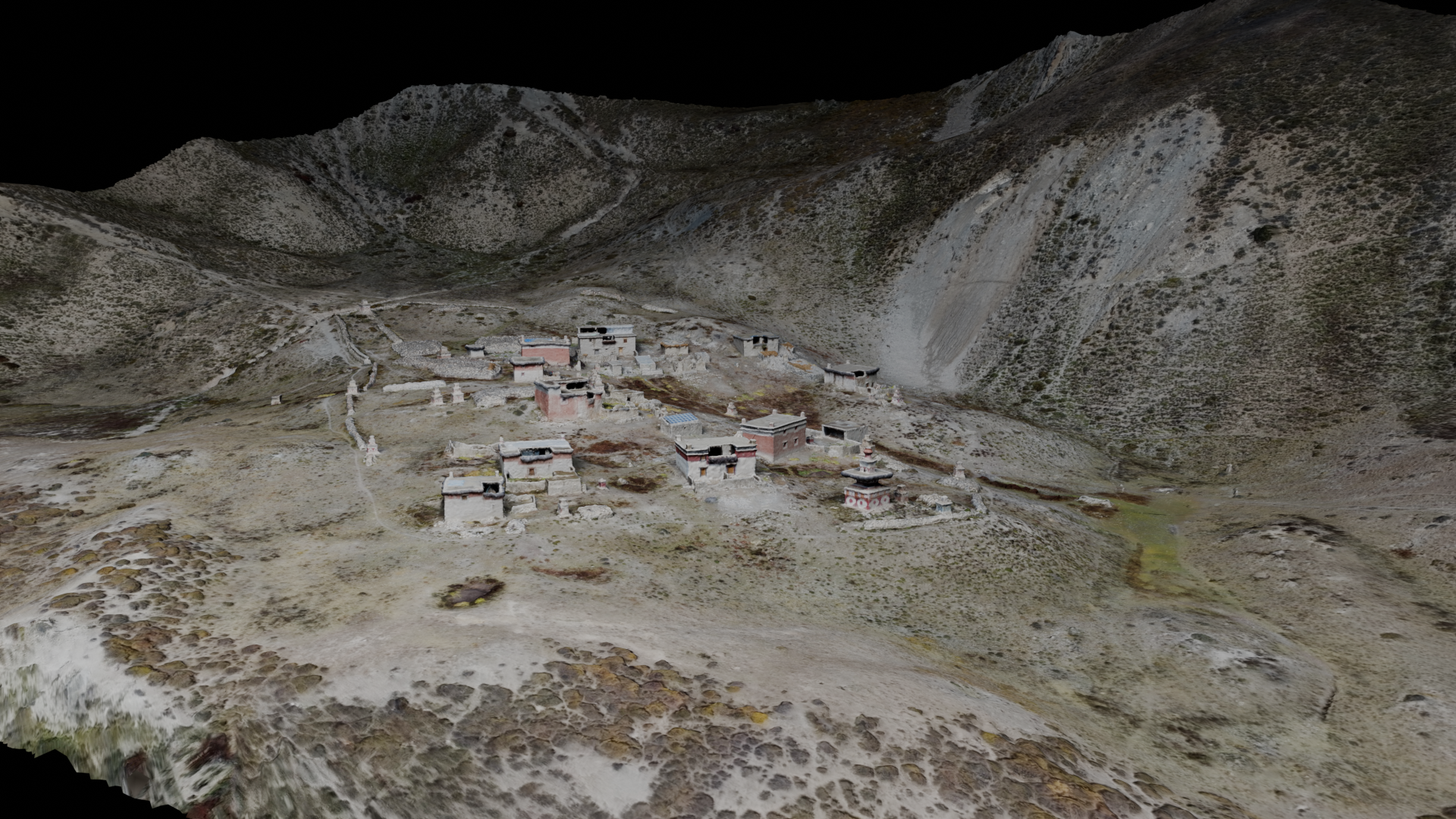
The aim of this interdisciplinary work was to explore significant Buddhist temple sites in Upper Dolpo, a remote area in Nepal, and to document several sites using modern 3D laser scanning technology. The derived models show a high level of detail and confidence, both from the outside and inside of the temple. Thus, they provide a solid data foundation for studying architectural connections in topologies of different sites and for further building research within the scientific community.
In order to reach a high accuracy level (within a few millimeters), the documentation strategy in the project was based on a combination of highly accurate laser scan data (Leica RTC360) and photogrammetric images. The individual laser scans were pre-registered in the field, and afterwards post-processed in the Leica Register 360 software. The registration was based on cloud-to-cloud registrations (in order to have a high mobility in the measurement setups), and – where possible - on stable reference points. The coordinates of these ground control points were determined using a geodetic total station (available only 2022) with redundant measurements in local geodetic network configuration.
This DOI represents the whole dataset gathered at the site in the fieldwork in 2022/2023. An overview of the site (JPG) and a down-sampled 3D model are provided herein for general distribution in order to avoid hidden inventory and provide these data to the commited scientific community. Please contact the authors if the complete data set and/or raw data (point cloud) is required for scientific research.
Files
Rendering3DModelSamling.png
Files
(263.7 MB)
| Name | Size | Download all |
|---|---|---|
|
md5:19d04815389881d58d3aeed4c9e1aa82
|
3.6 MB | Preview Download |
|
md5:1d1fb73c228d6fa6b68cb788fa9f8a8e
|
260.1 MB | Preview Download |
Additional details
Related works
- Is continued by
- https://archresearch.tugraz.at/results/samling/ (URL)
Funding
- FWF Austrian Science Fund
- Buddhist Architecture in the Western Himalayas P 35897-G